


Employment & Education
- since 2009 at Institute of Photogrammetry and Remote Sensing (IPF) at Karlsruhe Institute of Technology (KIT)
- 2024-2025 interim Professorship of Photogrammetry and Remote Sensing at Technische Universität München (TUM)
- 1997-2009 at Fraunhofer Institute of Optronics, System Technologies and Image Exploitation (IOSB)
- Venia Legendi (habil.) at Karlsruhe Institute of Technologie (KIT)
- Ph.D. degree (Dr.-Ing.) at Technische Universität München (TUM)
- Diploma degree (Dipl.-Ing.) in Electrical Engineering at Technische Universität Kaiserslautern
Interests
- Active Sensors
- Computer Vision
- Laser Scanning
- Optical Measurement Technology
- Signal & Image Processing
Lectures
- since 2009 at Karlsruhe Institute of Technology (KIT)
3D Computer Vision (LV 6041102)
Active Sensors for Computer Vision (LV 6043205)
Laser Scanning and Surface Modeling (LV 6020139)
Project Computer Vision (LV 6043104)
Sensors and Signals in Computer Vision and Remote Sensing (LV 6042201)
Exercise on Laser Scanning and Surface Modeling (LV 60201310)
Exercise on Statistical Pattern Recognition and Knowledge-based Image Analysis (LV 6043202)
Exercise on Structure and Object Extraction in 2D and 3D (LV 6043102) - 2024-2025 at Technische Universität München (TUM)
PF1 - Photogrammetry and Remote Sensing 1
PF2 - Photogrammetry and Remote Sensing 2 - 2019-2024 at Baden-Wuerttemberg Cooperative State University (DHBW) Karlsruhe
Digital Image Processing - 2007-2019 at Baden-Wuerttemberg Cooperative State University (DHBW) Mosbach
Digital Image Processing - 2007-2009 at University of Karlsruhe
- 2004-2023 at Technische Universität München (TUM)
PhD Supervisior/Reviewer
| [9] | Zhu J (28.05.2025) Fusion of Thermal Infrared Images and LiDAR Point Clouds for Urban Scene Mapping. Technische Universität München (TUM), TUM School of Engineering and Design, Department of Aerospace and Geodesy |
| [8] | Schäfer J (03.06.2024) Using Synthetic Datasets to Predict Forest Aboveground Biomass from Airborne Laser Scanning Data. Karlsruhe Institute of Technology (KIT) |
| [7] | Hanel A (29.11.2022) Geometric calibration of front cameras in vehicles for road scene acquisition. Technische Universität München (TUM), TUM School of Engineering and Design, Department of Aerospace and Geodesy |
| [6] | Blaser S (12.07.2022) Multi-environment Georeferencing of RGB-D Panoramic Images from Portable Mobile Mapping - a Perspective for Infrastructure Management. Karlsruhe Institute of Technology (KIT), Institute of Photogrammetry and Remote Sensing (IPF) |
| [5] | Hillemann M (21.02.2020) Kalibrierung von Multisensorsystemen mittels Geometrischer 3D Merkmale. Karlsruhe Institute of Technology (KIT), Institute of Photogrammetry and Remote Sensing (IPF) |
| [4] | Mueller M (06.12.2019) Camera Re-Localization with Data Augmentation by Image Rendering and Image-to-Image Translation. Karlsruhe Institute of Technology (KIT), Institute of Photogrammetry and Remote Sensing (IPF) |
| [3] | Ramezani M (05.07.2018) Robust and Accurate Localization by Visual-Inertial Odometry. The University of Melbourne, Department of Infrastructure Engineering |
| [2] | Richter K (02.07.2018) Analyse von full-waveform Flugzeuglaserscannerdaten zur volumetrischen Repräsentation in Umweltanwendungen. TU Dresden, Institute of Photogrammetry and Remote Sensing |
| [1] | Naab C (30.06.2016) Zur Optimierung der Offset-Korrektur bei der taktilen Erfassung von Freiformflächen. Karlsruhe Institute of Technology (KIT), Geodetic Institute Karlsruhe (GIK) |
Awards
↵
- Franz Hanke, Antonia Bieringer, Olaf Wysocki and Boris Jutzi - Best Paper Award at the 20th International 3D GeoInfo Conference 2025, 2025
- Simone Gaisbauer, Prabin Gyawali, Qilin Zhang, Olaf Wysocki and Boris Jutzi - Best Paper Award at 13th International Symposium on Mobile Mapping Technology (MMT 2025), 2025
- Miriam Jäger in collaboration with Patrick, Hübner, Dennis Haitz and Boris Jutzi - Best Paper Award at 12th International Symposium on Mobile Mapping Technology (MMT 2023), 2023
- Clémence Dubois in collaboration with Boris Jutzi, Marc Olijslagers, Carsten Pathe, Christiane Schmullius, Martyna Anna Stelmaszczuk-Górska, Danny Vandenbroucke and Martin Weinmann - ISPRS Best Young Author Award of the Technical Commission V (Education and Outreach) 2021, 2021
- Boris Jutzi - Faculty teaching award 2020 (Fakultätslehrpreis 2020
 ), 2020
 - Markus Mueller, Torsten Sattler, Marc Pollefeys and Boris Jutzi - Best Paper Award at Photogrammetric Image Analysis (PIA19), 2019
- Gottfried Mandlburger and Boris Jutzi - Best Paper Honourable Mention awarded at the ISPRS TC I Midterm Symposium “Innovative Sensing – From Sensors to Methods and Applications” 2018, 2018
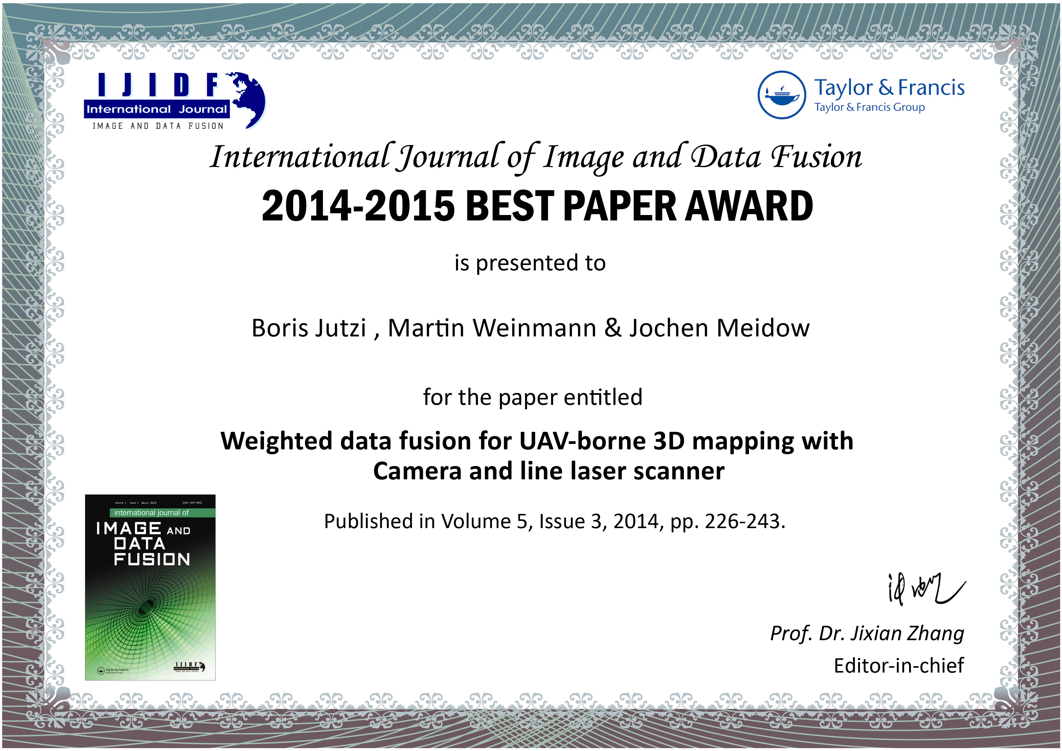
- Boris Jutzi, Martin Weinmann and Jochen Meidow - 2016 Best Paper Award of the International Journal of Image and Data Fusion for the term 2014-2015, 2016
- Martin Weinmann, Boris Jutzi and Clément Mallet - PCV 2014 Best Paper - Honourable Mention, 2014
- Boris Jutzi and Uwe Stilla - U. V. Helava Award - Best Paper of the ISPRS Journal 2006 , 2006
Chairing, Memberships & Organization
- Scientific Committee member ISAG2026 - International Symposium on Applied Geoinformatics – Ostrava, Czech Republic
- Scientific Committee member ISPRS Workshop 3D underwater mapping from above and below 2025 – Vienna, Austria
- Scientific Committee member ISPRS & EARSeL Joint Istanbul Workshop “Topographic Mapping from Space dedicated to Dr. Karsten Jacobsen’s 80th birthday” 2025 – Istanbul, Turkey
- Scientific Committee member IGARSS 2025 - IEEE/GRSS International Geoscience and Remote Sensing Symposium (IGARSS) – Brisbane, Australia
- Program Committee member Mobile Mapping for Autonomous Systems and Spatial Intelligence 2025 - International Conference on Mobile Mapping Technology (MMT) - Xiamen, China
- Scientific Committee member IGARSS 2024 - IEEE/GRSS International Geoscience and Remote Sensing Symposium (IGARSS) – Athens, Greece
- Scientific Committee member ISAG 2024 - International Symposium on Applied Geoinformatics – Wroclaw, Poland
- Scientific Committee member MMT 2023 - The 12th International Symposium On Mobile Mapping Technology – Padua, Italy
- Scientific Committee member IGARSS 2023 - IEEE/GRSS International Geoscience and Remote Sensing Symposium (IGARSS) – Pasadena, California, USA
- Program Committee member Photogrammetric Image Analysis (PIA19) - München, Germany
- Scientific Committee member ISPRS Geospatial Week – Laser Scanning 2019 Workshop of the ISPRS - Enschede, The Netherlands
- Symposium Committee member Innovative Sensing - From Sensors to Methods and Applications 2018. Midterm-Symposium of Commission I of the ISPRS - Karlsruhe, Germany
- Reviewing Committee member Towards Photogrammetry 2020. 2018 Symposium of Commission II of the ISPRS - Riva del Garda, Italy
- 2016-2022 Commission Secretary ISPRS Technical Commission I Sensor Systems
- 2012-2016 Commission Vice President ISPRS Technical Commission I Sensors and Platforms for Remote Sensing
- Program Committee member Photogrammetric Image Analysis (PIA15) & High-Resolution Earth Imaging for Geospatial Information (HRIGI), Joint Workshops of the ISPRS - München, Germany
- Program Committee member ISPRS Geospatial Week - Laserscanning 2015 Workshop of the ISPRS - Montpellier - La Grande Motte, France
- Science Committee member International Symposium on Computer Vision in Remote Sensing (CVRS 2015) - Xiamen, China
- Science Committee member ISPRS Geospatial Week - City Models, Roads and Traffic 2015 (CMRT15) - Workshop of the ISPRS - Montpellier - La Grande Motte, France
- Program Chair Sustaining Land Imaging: UAVs to Satellites - 2014 Symposium of Commission I of the ISPRS - Denver, USA
- Editorial Advisory Board member (2013-2016) of the ISPRS Journal of Photogrammetry and Remote Sensing (P&RS)
- Program Committee member High-Resolution Earth Imaging for Geospatial Information Workshop 2013 of the ISPRS - Hannover, Germany
- Program Committee member Laserscanning 2013 Workshop of the ISPRS - Shanghai, China
- 2008-2012 Working Group Chair ISPRS Working Group I/2 LIDAR, SAR and Optical Sensors for Airborne and Spaceborne Platforms
- Program Committee member High-Resolution Earth Imaging for Geospatial Information Workshop 2011 of the ISPRS - Hannover, Germany
- Program Committee member Laserscanning 2011 Workshop of the ISPRS - Calgary, Canada
- Conference Co-Chair Photogrammetric Image Analysis (PIA11) - Joint Workshop of the ISPRS - München, Germany
- Science Committee member LIDAR & RADAR 2011 - Nanjing, China
- Program Committee member Image Data Acquisition, Sensors & Platforms - Symposium of Commission I of the ISPRS 2010 - Calgary, Canada
- Program Committee member High-Resolution Earth Imaging for Geospatial Information Workshop 2009 of the ISPRS - Hannover, Germany
- Program Committee member Laserscanning 2009 Workshop of the ISPRS - Paris, France
- Program Committee member Photogrammetric Image Analysis (PIA07) - Joint Workshop of the ISPRS - München, Germany
- Program Committee member From Sensors to Imagery - Symposium of Commission I of the ISPRS 2006 - Paris, France
- Co-organiser 3D Mapping from InSAR and LiDAR - Workshop from WG I/2 of the ISPRS 2005 - Banff, Alberta, Canada
- 2004-2008 Working Group Secretary ISPRS Working Group I/2 SAR and LIDAR Systems
Editorships
-
Hinz S, Feitosa RQ, Weinmann M, Jutzi B (Eds) (2022) Technical Commission I, ISPRS Ann. Photogramm. Remote Sens. Spatial Inf. Sci., V-1-2022, 7–7, https://doi.org/10.5194/isprs-annals-V-1-2022-7-2022, 2022
-
Hinz S, Feitosa RQ, Weinmann M, Jutzi B (Eds) (2022) Technical Commission I, Int. Arch. Photogramm. Remote Sens. Spatial Inf. Sci., XLIII-B1-2022, 7–7, https://doi.org/10.5194/isprs-archives-XLIII-B1-2022-7-2022, 2022
-
Paparoditis N, Mallet C, Lafarge F, Yang MY, Hinz S, Feitosa R, Weinmann M, Jutzi B (Eds) (2021) XXIV ISPRS Congress, Commission I (Volume V-1-2021), ISPRS Ann. Photogramm. Remote Sens. Spatial Inf. Sci., V-1-2021, 1–150, https://www.isprs-ann-photogramm-remote-sens-spatial-inf-sci.net/V-1-2021/index.html, 2021
-
Paparoditis N, Mallet C, Lafarge F, Yang MY, Hinz S, Feitosa R, Weinmann M, Jutzi B (Eds) (2021) XXIV ISPRS Congress, Commission I (Volume XLIII-B1-2021), ISPRS Arch. Photogramm. Remote Sens. Spatial Inf. Sci., XLIII-B1-2021, 1–247, https://www.int-arch-photogramm-remote-sens-spatial-inf-sci.net/XLIII-B1-2021/index.html, 2021
-
Paparoditis N, Mallet C, Lafarge F, Hinz S, Feitosa R, Weinmann M, Jutzi B (Eds) (2020) XXIV ISPRS Congress, Commission I (Volume V-1-2020), ISPRS Ann. Photogramm. Remote Sens. Spatial Inf. Sci., V-1-2020, 1–400, https://doi.org/10.5194/isprs-annals-V-1-2020-7-2020, 2020
- Paparoditis N, Mallet C, Lafarge F, Hinz S, Feitosa R, Weinmann M, Jutzi B (Eds) (2020) XXIV ISPRS Congress, Commission I (Volume XLIII-B1-2020), ISPRS Arch. Photogramm. Remote Sens. Spatial Inf. Sci., XLIII-B1-2020, 1–642, https://doi.org/10.5194/isprs-archives-XLIII-B1-2020-7-2020, 2020
- Jutzi B, Weinmann M, Feitosa R, Hinz S (Eds) (2019) Special Issue 'Innovative Sensing - From Sensors to Methods and Applications'. ISPRS International Journal of Geo-Information (IJGI)
- Jutzi B, Weinmann M, Hinz S (Eds) (2018) Innovative Sensing - From Sensors to Methods and Applications. ISPRS Annals of the Photogrammetry, Remote Sensing and Spatial Information Sciences (Volume IV-1)
- Jutzi B, Weinmann M, Hinz S (Eds) (2018) Innovative Sensing - From Sensors to Methods and Applications. International Archives of the Photogrammetry, Remote Sensing and Spatial Information Sciences (Volume XLII-1)
- Heipke C, Soergel U, Rottensteiner F, Jutzi B (Eds) (2015) Theme Issue 'High-Resolution Earth Imaging for Geospatial Information' ISPRS Journal of Photogrammetry & Remote Sensing 100 (2015): 1-128
- Toth C, Jutzi B (Eds) (2014) ISPRS Technical Commission I Symposium "Sustaining Land Imaging: UAVs to Satellites". ISPRS Annals of the Photogrammetry, Remote Sensing and Spatial Information Sciences II-1, 2014
- Toth C, Holm T, Jutzi B (Eds) (2014) ISPRS Technical Commission I Symposium "Sustaining Land Imaging: UAVs to Satellites". ISPRS Archives of the Photogrammetry, Remote Sensing and Spatial Information Sciences XL-1, 2014
- Stilla U, Rottensteiner F, Mayer H, Jutzi B, Butenuth M (Eds) (2011) Photogrammetric Image Analysis. Lecture Notes in Computer Science - LNCS 6952, Springer: Heidelberg [doi:10.1007/978-3-642-24393-6]
- Stilla U, Rottensteiner F, Mayer H, Jutzi B, Butenuth M (Eds) (2011) Photogrammetric Image Analysis PIA11. International Archives of Photogrammetry, Remote Sensing and Spatial Information Sciences 36 (Part 3/W22)
- Stilla U, Rottensteiner F, Mayer H, Jutzi B, Schmitt M (Eds) (2011) Special Issue: Photogrammetric Image Analysis. PFG Photogrammetrie - Fernerkundung - Geoinformation. Stuttgart: Schweizerbartsche Verlagsbuchhandlung. 2012 (5)
Selected Talks
↵
-
22.10.2025 Auf den Punkt gebracht - Ausgewählte Forschungsthemen in der Photogrammetrie und Vermessung. Geodätisches Kolloquium Universität Innsbruck, Innsbruck, Austria
-
12.12.2024 TUM2TWIN - Introducing large-scale multi-modal Urban Digital Twin Benchmark dataset. Optical 3D Metrology (O3DM) Workshop, Brescia, Italy
- 09.10.2023 Einführung in das Terrestrische Laserscanning. THWS Würzburg, Würzburg, Germany
- 26.01.2023 Extrinsic LiDAR Self-Calibration of Mapping Platforms. 3rd International EuroSDR Workshop on Point Cloud Processing, Stuttgart, Germany
- 23.11.2022 Extrinsic Self-Calibration of LiDAR-based Mapping Systems by Means of Geometric 3D Features. 4th International MoLaS Workshop, Freiburg, Germany
- 13.10.2020 Szenenerfassung mit Laserscanning: Sensoren, Plattformen und Methoden. Geomatik Herbst-Kolloquium 2020, Fachhochschule Nordwestschweiz (FHNW), Muttenz, Switzerland
- 02.03.2020 3D Sensing, Scene Reconstruction and Semantic Interpretation (30 March - 10 April 2020) Tutors: Martin Weinmann (Karlsruhe Institute of Technology), Michael Weinmann (University of Bonn), Franz Rottensteiner (Leibniz Universität Hannover), Boris Jutzi (Karlsruhe Institute of Technology). EuroSDR series of e-learning. Marne-la-Vallée, France
- 04.12.2019 Self-Calibration for LiDAR-based Mobile Mapping Systems. 2nd International EuroSDR Workshop on Point Cloud Processing, Stuttgart, Germany
- 01.04.2019 3D Sensing, Scene Reconstruction and Semantic Interpretation (1-12 April 2019) Tutors: Martin Weinmann (Karlsruhe Institute of Technology), Michael Weinmann (University of Bonn), Franz Rottensteiner (Leibniz Universität Hannover), Boris Jutzi (Karlsruhe Institute of Technology). EuroSDR series of e-learning
- 06.11.2018 3D Computer Vision. Poster-Präsentation beim „Forum für Lehre“ von Markus Hillemann, Markus Mueller, Boris Jutzi. Karlsruhe, Germany
- 03.06.2018 From Active Optical 3D Sensing to Descriptive Features. Tutorial on “Acquisition and Automatic Characterization of Scenes – A holistic approach for scene analysis in terms of semantic labeling and object extraction” together with Michael Weinmann (University of Bonn), Martin Weinmann (KIT) and Franz Rottensteiner (Leibniz Universität Hannover) at Symposium of Commission II of the ISPRS. Riva del Garda, Italy
- 01.06.2018 CVG meets IPF – Selected Topics on Computer Vision. Talk at Department of Computer Science, Computer Vision and Geometry Group, Eidgenössische Technische Hochschule (ETH). Zürich, Switzerland
- 13.12.2017 Very high resolution 3D reconstruction using LiDAR. CAST Summer School on Signal Processing in Earth Observation. München, Germany
- 12.09.2017 Less Photons for more LiDAR? A Review from Multi-Photon-Detection to Single-Photon-Detection. Invited talk at Photogrammetric Week 2017. Stuttgart, Germany
- 06.09.2017 Point Cloud Analysis for UAV-Borne Laser Scanning with Horizontally and Vertically Oriented Line Scanners – Concept and First Results. UAV-g 2017. Bonn, Germany
- 26.10.2016 Active-Optical Sensing: State-of-the-Art and Challenges. Session I, Introduction on Active Electro-Optical Sensing. Session II, Feature Extraction and Semantic Interpretation. Session III, 2D/3D Registration: Fusing Thermal and Range Data. Hands-on-Experiences, ICP and Image-based Registration of Point Clouds. Graduate School Course in Geomatics 2016 on Perspectives of 3D: From georeferencing of mobile measuring systems to registration and interpretation of point clouds. Aalto University School of Engineering. Espoo, Finland
- 07.10.2016 On Point-Cloud Analysis. Keynote speech at the TUM-DLR Summer School 2016. Beilngries, Germany
- 11.07.2016 With Active Optical Sensing to Labeled 3D Points. Tutorial on „Acquisition and Automatic Characterization of Scenes - From Point Clouds to Features and Objects“ together with Michael Weinmann (University of Bonn), Martin Weinmann (KIT) and Franz Rottensteiner (Leibniz Universität Hannover) at ISPRS Congress 2016, Prague, Czech Republic
- 28.01.2016 Strukturierte Lichtprojektion Sensoren und Time-of-Flight Entfernungskameras in der Photogrammetrie. Gastvortrag an der TU Darmstadt. Darmstadt, Germany
- 03.12.2015 Neue aktive optische Sensoren - Viel Licht und wenig(er) Schatten? Antrittsvorlesung im Rahmen des Geodätischen Kolloquiums am KIT. Karlsruhe, Germany
- 22.07.2015 Vom 3D-Punkt zur Szenencharakterisierung - Ein breiter Methoden- und Anwendungskanon aus Computer Vision, Photogrammetrie und Fernerkundung. Habilitationsvortrag. Karlsruhe, Germany
- 17.07.2015 Klassifizierung von Full-Waveform Airborne Laserscanning Daten zur Bestimmung von Vorlandrauheiten. Abschlussvortrag zum FuE-Projekt „Vorlandrauheiten an BWaStr“. Koblenz, Germany
- 12.06.2015 Klassifizierung von Full-Waveform ALS Daten zur Bestimmung von Vorlandrauheiten. Eingeladener Vortrag gehalten bei der Bundesanstalt für Wasserbau (BAW). Karlsruhe, Germany
- 27.01.2015 Photogrammetrische Kleinplattformen. Deutscher Verein für Vermessungswesen (DVW) am KIT. Karlsruhe, Germany
- 20.11.2014 Thermal 3D Mapping for Object Detection in Dynamic Scenes. Pecora 19 Symposium in conjunction with the Joint Symposium of the ISPRS Technical Commission I and IAG Commission 4. Denver, USA
- 24.10.2014 Active Optical Sensing – Selected Methods and Technologies. Invited talk at Workshop „Ten talks on LiDAR in Forest“ hosted by University of Helsinki. Helsinki, Finland
- 25.09.2014 From 3D Points to Relevant Features. Invited talk at Workshop „3D vegetation mapping using advanced remote sensing – implications for seamless modeling of terrestrial ecosystems“. Grafenau, Germany
- 09.05.2014 Being Active - Sensing for 3D Vision. Lectures at Yıldız Teknik Üniversitesi, Istanbul, Turkey
- 29.11.2013 Sensoren zur Erfassung der Umgebung - Einsatzgebiete und Möglichkeiten. Fach-symposium HybridSensorNet. Karlsruhe, Germany
- 06.09.2013 Improved UAV-borne 3D mapping by fusing optical and laserscanner data. UAV-g 2013. Rostock, Germany
- 28.08.2013 New Methods and Technologies in Active Sensing. Invited talk at University of Alaska Fairbanks (Alaska), USA
- 22.04.2013 Fast and Accurate Point Cloud Registration by Exploiting Inverse Cumulative Histograms (ICHs). Joint Urban Remote Sensing Event, JURSE 2013. São Paulo, Brazil
- 19.04.2013 From LIDAR data to objects. Invited talk at Universidade Federal do Paraná. Curitiba, Paraná State, Brazil
- 14.04.2013 Object Extraction and Classification via Full Waveform Lidar. Invited talk at the Workshop Novos Avanços nas Tecnologias de Laser Scanner Aerotransportável (New Advancements in Airborne Lidar Technology). XVI SBSR - Brazilian Remote Sensing Symposium. Foz do Iguaçu City, Paraná State, Brazil
- 13.04.2013 Full waveform LIDAR applications. Short course at XVI SBSR - Brazilian Remote Sensing Symposium. Foz do Iguaçu City, Paraná State, Brazil
- 13.04.2013 Feature extraction from LIDAR data. Short course at XVI SBSR - Brazilian Remote Sensing Symposium. Foz do Iguaçu City, Paraná State, Brazil
- 30.08.2012 A step towards dynamic scene analysis with active multi-view range imaging systems. XXII ISPRS Congress: Imaging a sustainable future. Melbourne, Australia
- 29.08.2012 Voxel-based approach for estimating urban tree volume from terrestrial laser scanning data. XXII ISPRS Congress: Imaging a sustainable future. Melbourne, Australia
- 26.08.2012 Fusing passive and active sensed images to gain infrared-textured 3D models. XXII ISPRS Congress: Imaging a sustainable future. Melbourne, Australia
- 09.07.2012 Digitale 3D-Objekterfassung als Beitrag zum Erhalt von Kulturerbe. Treffen des Kompetenzfeldes Kulturerbe und sozialer Wandel. Karlsruhe, Germany
- 21.03.2012 Aktive Sensorik in der Computer Vision. Geo-BOGY am Studiengang Geodäsie und Geoinformatik. Karlsruhe, Germany
- 16.11.2011 Eintauchen in die virtuelle 3D-Welt. Uni für Einsteiger am KIT. Karlsruhe, Germany
- 09.11.2011 Three-dimensional acquisition of archaeological objects (Part II). 2nd Workshop on Buddhist Historical Sites from a World Heritage Perspective - The Example of Andhra Pradesh. Hyderabad, India
- 27.06.2011 Three-dimensional acquisition of archaeological objects. Workshop on Buddhist Historical Sites from a World Heritage Perspective - The Example of Andhra Pradesh. Karlsruhe, Germany
- 07.04.2011 Potentiale von Full-Waveform Laserscanning für die hydrologische/hydraulische Modellierung. Kolloquium der Bundesanstalt für Gewässerkunde (BfG) zur Zeitgemäße Erfassung und Bereitstellung von Geobasisdaten für die WSV. Koblenz, Germany
- 14.10.2010 Range Imaging. 3. Fortbildungsseminar am KIT - Optische Messtechnik für Anwendungen im Maschinenbau. Karlsruhe, Germany
- 08.06.2010 An Introduction to Full-Waveform Laser Scanning. Invited talk at the Delft University of Technology. Delft, the Netherlands
- 26.03.2010 Modelling and Analysis of full-waveform laser data. Institutsseminar am Deutschen Zentrum für Luft- und Raumfahrt (DLR) Institut für Hochfrequenztechnik und Radarsysteme. Oberpfaffenhofen-Weßling, Germany
- 25.09.2009 Architectural applications - a challenge for active sensing. Seminário Internacional Tecnologias Digitais Aplicadas à Documentação Arquitetônica. Salvador da Bahia, Brazil
- 02.09.2009 Normalization of lidar intensity data based on range and surface incidence angle. Workshop on Laserscanning 2009. Paris, France
- 02.06.2009 Nearest neighbour classification on Laser point clouds to gain object structures from buildings. Workshop on High-resolution Earth Imaging for Geospatial Information. Hanover, Germany
- 25.03.2009 Classification of Elevation Data based on analytical versus trained Feature Values to determine Object Boundaries. 29. Wissenschaftlich-Technische Jahrestagung der DGPF. Jena, Germany
- 05.11.2008 Hyperspectral review. German-Israel cooperation. Tel Aviv, Israel
- 16.10.2008 Messkampagne mit Hyperspektral Sensor & Datenauswertung. Deutsches Zentrum für Luft- und Raumfahrt (DLR) Institut für Robotik und Mechatronik, Sensorkonzepte- und Anwendungen, Einrichtung Optische Informationssysteme. Berlin-Adlershof, Germany
- 25.09.2007 Analyse der Signalform von rückgestreuten Laserpulsen. Promotionsvortrag an der TUM. München, Germany
- 22.09.2006 Precise range estimation on known surfaces by analysis of full-waveform laser. Symposium of ISPRS Commission III: Photogrammetric Computer Vision PCV06. Bonn, Germany
- 05.07.2006 Characteristics of the measurement unit of a full-waveform laser system. Symposium of ISPRS Commission I: From Sensors to Imagery. Paris, France
- 27.04.2006 Bildverarbeitung & 3D Sehen. Girlsday. Ettlingen, Germany
- 04.10.2005 Measuring and processing the waveform of laser pulses. 7th Conference on Optical 3D Measurement Techniques. Vienna, Austria
- 13.09.2005 Sub-pixel edge localization based on laser waveform analysis. Workshop on Laserscanning 2005. Enschede, the Netherlands
- 08.06.2005 Waveform analysis of laser pulses for gaining range accuracy. Banff 2005 Workshop on 3D Mapping from InSAR and LiDAR. Banff, Canada
- 19.05.2005 High-Resolution waveform acquisition and analysis for pulsed laser. Workshop on High-resolution earth imaging for geospatial information. Hanover, Germany
- 14.03.2005 Waveform processing of laser pulses for reconstruction of surfaces in urban areas. 3rd International Symposium: Remote sensing and data fusion on urban areas, URBAN 2005. Tempe (AZ), USA
- 03.02.2005 Erfassung und Analyse der zeitlichen Signalform bei gepulsten Lasersystemen. Oldenburger 3D-Tage: Photogrammetrie - Laser-Scanning - Optische 3D-Messtechnik. Oldenburg, Germany
- 16.07.2004 Extraction of features from objects in urban areas using space-time analysis of recorded laser pulses. XXth ISPRS Congress: Geo-Imagery Bridging Continents. Istanbul, Turkey
- 18.09.2003 Laser pulse analysis for reconstruction and classification of urban objects. Workshop on Photogrammetric Image Analysis PIA’03. Munich, Germany
- 22.05.2003 Analysis of laser pulses for gaining surface features of urban objects. 2nd IEEE GRSS/ISPRS Joint Workshop on Remote Sensing and data fusion on urban areas, URBAN 2003. Berlin, Germany
- 25.09.2002 Estimation and measurement of backscattered signals from pulsed laser radar. The International Society for Optics and Photonics (SPIE) Image and signal processing for remote sensing VIII. Agia Pelagia (Crete), Greece
- 02.08.2001 Stereo vision for small targets in IR image sequences. The International Symposium on Optical Science and Technology (SPIE) Signal and Data Processing of Small Targets. San Diego (California), USA
Publikationsliste
-
Scutelnic, D.; Daffara, C.; Muradore, R.; Weinmann, M.; Jutzi, B. (2026). Multi-model ensembles for object detection in multispectral images: A case study for precision agriculture. Computers and Electronics in Agriculture, 240, 111213. doi:10.1016/j.compag.2025.111213
-
You, T.; Greza, M.; Jutzi, B. (2025). U-Net- and Transformer-Based Cloud Masking for Multispectral Earth Observation Satellite Missions. IEEE International Geoscience and Remote Sensing Symposium (IGARSS 2025), 8005–8009, Institute of Electrical and Electronics Engineers (IEEE). doi:10.1109/IGARSS55030.2025.11242475
-
Jäger, M.; Hillemann, M.; Jutzi, B. (2025). FeatureGS: Eigenvalue-feature optimization in 3D Gaussian Splatting for geometrically accurate and artifact-reduced reconstruction. ISPRS Open Journal of Photogrammetry and Remote Sensing, 17, 100100. doi:10.1016/j.ophoto.2025.100100
-
Greza, M.; Plantenberg, F.; Jutzi, B. (2025, Juni 24). SpaceMASt3R: Map-based Georeferencing of Line Scanner Satellite Imagery utilizing Deep Neural Networks. Scandinavian Conference on Image Analysis 2025. 23th Scandinavian Conference on Image Analysis (SCIA 2025), Reykjavík, Island, 22.–25. Juni 2025.
-
Brezovsky, M.; Schulte, F.; Günthner, A. S.; Winiwarter, L.; Jutzi, B.; Mandlburger, G. (2025, Juni 5). Bathymetrieerfassung mittels Neural Radiance Fields - Konzeptionelle Herausforderungen und erste Erkenntnisse. Dreiländertagung D-A-CH "Raumbezogene Bilddaten und Künstliche Intelligenz für nachhaltige Lebensräume" (2025), Muttenz, Schweiz, 3.–5. Juni 2025.
-
Petrovska, I.; Jutzi, B. (2025). Seeing beyond vegetation: A comparative occlusion analysis between Multi-View Stereo, Neural Radiance Fields and Gaussian Splatting for 3D reconstruction. ISPRS Open Journal of Photogrammetry and Remote Sensing, 16, 100089. doi:10.1016/j.ophoto.2025.100089
-
Jäger, M.; Landgraf, S.; Jutzi, B. (2025). Density uncertainty quantification with NeRF-Ensembles: Impact of data and scene constraints. International Journal of Applied Earth Observation and Geoinformation, 137, Article no: 104406. doi:10.1016/j.jag.2025.104406
-
Hoegner, L.; Greza, M.; Frank, F.; Worbis, S.; Heblinski, J.; Wasmeier, P.; Czaja, J.; Jutzi, B.; Hoffmann, F. (2025). Laser oder Bilder? Boden oder Luft? Vergleichende Untersuchungen zur 3D Rekonstruktion in nicht-urbanen, natürlichen Umgebungen. 23. Internationale Geodätische Woche Obergurgl 2025. Hrsg.: T. Weinold, 16–25, Wichmann Verlag.
-
Greza, M.; Hoegner, L.; Jutzi, B. (2025). Werden Kleinsatelliten klassische Erdbeobachtungssatelliten ersetzen?. 23. Internationale Geodätische Woche Obergurgl 2025. Hrsg.: T. Weinold, 285–288, Wichmann Verlag.
-
Gaisbauer, S.; Gyawali, P.; Zhang, Q.; Wysocki, O.; Jutzi, B. (2025). To Glue or Not to Glue? Classical vs Learned Image Matching for Mobile Mapping Cameras to Textured Semantic 3D Building Models. ISPRS Annals of the Photogrammetry, Remote Sensing and Spatial Information Sciences, X-1/W2-2025, 35–42. doi:10.5194/isprs-annals-X-1-W2-2025-35-2025
-
Hanke, F.; Bieringer, A.; Wysocki, O.; Jutzi, B. (2025). CM2LoD3: Reconstructing LoD3 Building Models Using Semantic Conflict Maps. ISPRS Annals of the Photogrammetry, Remote Sensing and Spatial Information Sciences, X-4/W6-2025, 81–88. doi:10.5194/isprs-annals-X-4-W6-2025-81-2025
-
Petrovska, I.; Jutzi, B. (2025). Impact of Rain on 3D Reconstruction with Multi-View Stereo, Neural Radiance Fields and Gaussian Splatting. ISPRS Annals of the Photogrammetry, Remote Sensing and Spatial Information Sciences, X-4/W6-2025, 169–176. doi:10.5194/isprs-annals-X-4-W6-2025-169-2025
-
Zhang, Q.; Wysocki, O.; Jutzi, B. (2025). GS4Buildings: Prior-Guided Gaussian Splatting for 3D Building Reconstruction. 20th 3D GeoInfo Conference 2025, 2–5 September 2025, Kashiwa, Japan, 249–256, Copernicus Publications. doi:10.5194/isprs-annals-X-4-W6-2025-249-2025
-
You, T.; Greza, M.; Jutzi, B. (2025). Resource-optimized Cloud Masking via Federated Learning for Multispectral Small Satellite Earth Observation Missions. Helmholtz AI Conference: AI for Science (HAICON 2025), Karlsruhe, Deutschland, 3.–5. Juni 2025.
-
Wysocki, O.; Schwab, B.; Biswanath, M. K.; Greza, M.; Zhang, Q.; Zhu, J.; Froech, T.; Heeramaglore, M.; Hijazi, I.; Kanna, K.; Pechinger, M.; Chen, Z.; Sun, Y.; Segura, A. R.; Xu, Z.; AbdelGafar, O.; Mehranfar, M.; Yeshwanth, C.; Liu, Y.-C.; Yazdi, H.; Wang, J.; Auer, S.; Anders, K.; Bogenberger, K.; Borrmann, A.; Dai, A.; Hoegner, L.; Holst, C.; Kolbe, T. H.; Ludwig, F.; Nießner, M.; Petzold, F.; Zhu, X. X.; Jutzi, B. (2025). TUM2TWIN: Introducing the Large-Scale Multimodal Urban Digital Twin Benchmark Dataset. arxiv. doi:10.48550/arXiv.2505.07396
-
Petrovska, I.; Jutzi, B. (2025). 3D Gaussian Splatting Methods for Real-World Scenarios. ISPRS Annals of the Photogrammetry, Remote Sensing and Spatial Information Sciences, X-G-2025, 641–648. doi:10.5194/isprs-annals-X-G-2025-641-2025
-
Kang, S.; Liao, M. Y.; Xia, Y.; Wysocki, O.; Jutzi, B.; Cremers, D. (2025). OPAL: Visibility-aware LiDAR-to-OpenStreetMap Place Recognition via Adaptive Radial Fusion. arxiv. doi:10.48550/arXiv.2504.19258
-
Schulte, F.; Brezovsky, M.; Günthner, A.; Jutzi, B.; Mandlburger, G.; Winiwarter, L. (2025). Simulation and validation of underwater scenes for two-media optical 3D reconstruction. The International Archives of the Photogrammetry, Remote Sensing and Spatial Information Sciences, XLVIII-2/W10-2025, 271–278. doi:10.5194/isprs-archives-XLVIII-2-W10-2025-271-2025
-
Brezovsky, M.; Günthner, A.; Schulte, F.; Winiwarter, L.; Jutzi, B.; Mandlburger, G. (2025). Analysis of refraction aware Neural Radiance Fields for 3D reconstruction of through the water scenes. The International Archives of the Photogrammetry, Remote Sensing and Spatial Information Sciences, XLVIII-2/W10-2025, 39–45. doi:10.5194/isprs-archives-XLVIII-2-W10-2025-39-2025
-
Günthner, A.; Brezovsky, M.; Schulte, F.; Winiwarter, L.; Mandlburger, G.; Jutzi, B. (2025). Exploring the Potential of Refractive NeRFs for Photogrammetric Bathymetry - First Application to UAV-based Data from the Pielach River. The International Archives of the Photogrammetry, Remote Sensing and Spatial Information Sciences, XLVIII-2/W10-2025, 107–114. doi:10.5194/isprs-archives-XLVIII-2-W10-2025-107-2025
-
Gaisbauer, S.; Gyawali, P.; Zhang, Q.; Wysocki, O.; Jutzi, B. (2025). To Glue or Not to Glue? Classical vs Learned Image Matching for Mobile Mapping Cameras to Textured Semantic 3D Building Models. arxiv. doi:10.48550/arXiv.2505.17973
-
Tang, W.; Li, W.; Liang, X.; Wysocki, O.; Biljecki, F.; Holst, C.; Jutzi, B. (2025). Texture2LoD3: Enabling LoD3 Building Reconstruction With Panoramic Images. arxiv. doi:10.5445/IR/1000181241
-
Mandlburger, G.; Rhomberg-Kauert, J.; Gueguen, L.-A.; Mulsow, C.; Brezovsky, M.; Dammert, L.; Haines, J.; Glas, S.; Himmelsbach, T.; Schulte, F.; Amon, P.; Winiwarter, L.; Jutzi, B.; Maas, H.-G. (2025). Mapping shallow inland running waters with UAV-borne photo and laser bathymetry : The Pielach River showcase. Journal of applied hydrography = Hydrographische Nachrichten, 130 (3), 42–54. doi:10.23784/HN130-06
-
Winiwarter, L.; Schulte, F.; Wang, J.; Zhang, Q.; Anders, K.; Jutzi, B. (2025). Assessing the Potential of Neural Radiance Fields and Gaussian Splatting for Change Detection and Change Quantification. 6th Joint International Symposium on Deformation Monitoring (JISDM 2025), Karlsruhe, 07.-09.04.2025, Karlsruher Institut für Technologie (KIT). doi:10.5445/IR/1000180533
-
Greza, M.; Bhattacharyya, I.; You, T.; Hoegner, L.; Jutzi, B. (2025). Multispectral Remote Sensing Data Enhancement for Automatic Processing Chains : A U-Net- vs Transformer-based Cloud Segmentation and GAN Super Resolution Approach. doi:10.5445/IR/1000179533
-
Nex, F.; Stathopoulou, E. K.; Remondino, F.; Yang, M. Y.; Madhuanand, L.; Yogender, Y.; Alsadik, B.; Weinmann, M.; Jutzi, B.; Qin, R. (2024). UseGeo - A UAV-based multi-sensor dataset for geospatial research. ISPRS Open Journal of Photogrammetry and Remote Sensing, 13, Article no: 100070. doi:10.1016/j.ophoto.2024.100070
-
Hermann, M.; Weinmann, M.; Nex, F.; Stathopoulou, E. K.; Remondino, F.; Jutzi, B.; Ruf, B. (2024). Depth estimation and 3D reconstruction from UAV-borne imagery: Evaluation on the UseGeo dataset. ISPRS Open Journal of Photogrammetry and Remote Sensing, 13, Art.-Nr.: 100065. doi:10.1016/j.ophoto.2024.100065
-
Jäger, M.; Kapler, T.; Feßenbecker, M.; Birkelbach, F.; Hillemann, M.; Jutzi, B. (2024). HoloGS: Instant Depth-based 3D Gaussian Splatting with Microsoft HoloLens 2. The International Archives of the Photogrammetry, Remote Sensing and Spatial Information Sciences, XLVIII-2-2024, 159 – 166. doi:10.5194/isprs-archives-XLVIII-2-2024-159-2024
-
Zhang, Q.; Wysocki, O.; Urban, S.; Jutzi, B. (2024). CDGS: Confidence-Aware Depth Regularization for 3D Gaussian Splatting. The International Archives of the Photogrammetry, Remote Sensing and Spatial Information Sciences, XLVIII-2/W7-2024, 189–196. doi:10.5194/isprs-archives-XLVIII-2-W7-2024-189-2024
-
Greza, M.; Bhattacharya, I.; Hoegner, L.; Jutzi, B. (2024). GAN-Based Dual Image Super Resolution for Satellite Imagery Decreasing Radiometric Uncertainty. ISPRS Annals of the Photogrammetry, Remote Sensing and Spatial Information Sciences, X-3-2024, 155–162. doi:10.5194/isprs-annals-X-3-2024-155-2024
-
Jäger, M.; Kapler, T.; Feßenbecker, M.; Birkelbach, F.; Hillemann, M.; Jutzi, B. (2024). HoloGS: Instant Depth-based 3D Gaussian Splatting with Microsoft HoloLens 2. doi:10.48550/arXiv.2405.02005
-
Petrovska, I.; Jutzi, B. (2024). Vision through Obstacles—3D Geometric Reconstruction and Evaluation of Neural Radiance Fields (NeRFs). Remote Sensing, 16 (7), Art.-Nr.: 1188. doi:10.3390/rs16071188
-
Haitz, D.; Hübner, P.; Ulrich, M.; Jutzi, B. (2023). A comparison of learning-based approaches for the corrosion detection on barrels in industrial applications. tm - Technisches Messen, 90 (7-8), 522–532. doi:10.1515/teme-2023-0009
-
Petrovska, I.; Jäger, M.; Haitz, D.; Jutzi, B. (2023). Geometric Accuracy Analysis Between Neural Radiance Fields (NERFS) and Terrestrial Laser Scanning (TLS). The International Archives of the Photogrammetry, Remote Sensing and Spatial Information Sciences, XLVIII-1/W3-2023, 153–159. doi:10.5194/isprs-archives-XLVIII-1-W3-2023-153-2023
-
Jäger, M.; Jutzi, B. (2023). 3D Density-Gradient Based Edge Detection on Neural Radiance Fields (NERFS) for Geometric Reconstruction. The International Archives of the Photogrammetry, Remote Sensing and Spatial Information Sciences, XLVIII-1/W3-2023, 71–78. doi:10.5194/isprs-archives-XLVIII-1-W3-2023-71-2023
-
Haitz, D.; Jutzi, B.; Ulrich, M.; Jäger, M.; Hübner, P. (2023). Combining Hololens with Instant-NeRFs: Advanced Real-Time 3D Mobile Mapping. The International Archives of the Photogrammetry, Remote Sensing and Spatial Information Sciences, XLVIII-1/W1-2023, 167 – 174. doi:10.5194/isprs-archives-XLVIII-1-W1-2023-167-2023
-
Haitz, D.; Jutzi, B.; Ulrich, M.; Jäger, M.; Huebner, P. (2023). Combining HoloLens with Instant-NeRFs: Advanced Real-Time 3D Mobile Mapping. arxiv. doi:10.48550/arXiv.2304.14301
-
Jäger, M.; Hübner, P.; Haitz, D.; Jutzi, B. (2023). A comparative Neural Radiance Field (NERF) 3D analsyis of camera poses from HoloLens trajectories and structure from motion. The International Archives of the Photogrammetry, Remote Sensing and Spatial Information Sciences, XLVIII-1/W1-2023, 207–213. doi:10.5194/isprs-archives-XLVIII-1-W1-2023-207-2023
-
Hinz, S.; Feitosa, R. Q.; Weinmann, M.; Jutzi, B. (2022). Preface: Technical Commission I. ISPRS Annals of the Photogrammetry, Remote Sensing and Spatial Information Sciences, XLIII-B1-2022, 7. doi:10.5194/isprs-archives-XLIII-B1-2022-7-2022
-
Hinz, S.; Feitosa, R. Q.; Weinmann, M.; Jutzi, B. (2022). Preface: Technical Commission I. ISPRS Annals of the Photogrammetry, Remote Sensing and Spatial Information Sciences, V-1-2022, 7. doi:10.5194/isprs-annals-V-1-2022-7-2022
-
Haitz, D.; Hübner, P.; Ulrich, M.; Landgraf, S.; Jutzi, B. (2022). Semantic segmentation with small training datasets: A case study for corrosion detection on the surface of industrial objects. Forum Bildverarbeitung 2022. Ed.: T. Längle; M. Heizmann, 73–85, KIT Scientific Publishing.
-
Haitz, D.; Jutzi, B.; Hübner, P.; Ulrich, M. (2022). Corrosion detection for industrial objects: from multi-sensor system to 5D feature space. The International Archives of the Photogrammetry, Remote Sensing and Spatial Information Sciences, XLIII-B1-2022, 143–150. doi:10.5194/isprs-archives-XLIII-B1-2022-143-2022
-
Bertels, M.; Jutzi, B.; Ulrich, M. (2022). Automatic Real-Time Pose Estimation of Machinery from Images. Sensors, 22 (7), 2627. doi:10.3390/s22072627
-
Weinmann, M.; Wursthorn, S.; Jutzi, B. (2021). From Raw 3D Point Clouds to Semantic Objects. Object and Pattern Recognition in Remote Sensing. Ed.: S. Hinz, 151–178, Whittles Publishing.
-
Hinz, S.; Feitosa, R. Q.; Weinmann, M.; Jutzi, B. (2021). Preface: Technical Commission I. The International Archives of the Photogrammetry, Remote Sensing and Spatial Information Sciences, XLIII-B1-2021, 7. doi:10.5194/isprs-archives-XLIII-B1-2021-7-2021
-
Hinz, S.; Feitosa, R. Q.; Weinmann, M.; Jutzi, B. (2021). Preface: Technical Commission I. ISPRS annals, V-1-2021, 7. doi:10.5194/isprs-annals-V-1-2021-7-2021
-
Dubois, C.; Jutzi, B.; Olijslagers, M.; Pathe, C.; Schmullius, C.; Stelmaszczuk-Górska, M. A.; Vandenbroucke, D.; Weinmann, M. (2021). Knowledge and skills related to active optical sensors in the body of knowledge for earth observation and geoinformation (EO4GEO BOK). ISPRS annals, V-5-2021, 9–16. doi:10.5194/isprs-annals-V-5-2021-9-2021
-
Braun, A. C.; Weinmann, M.; Wursthorn, S.; Keller, S.; Schenk, A.; Jutzi, B.; Hinz, S. (2021). Remote Sensing and Computer Vision Image Analysis: Summary and Recent Trends. Object and pattern recognition in remote sensing. Ed.: S. Hinz, 323–346, Whittles Publishing.
-
Weinmann, M.; Jäger, M. A.; Wursthorn, S.; Jutzi, B.; Weinmann, M.; Hübner, P. (2020). 3D Indoor Mapping with the Microsoft HoloLens: Qualitative and Quantitative Evaluation by Means of Geometric Features. ISPRS annals, V-1-2020, 165–172. doi:10.5194/isprs-annals-V-1-2020-165-2020
-
Hinz, S.; Feitosa, R. Q.; Weinmann, M.; Jutzi, B. (2020). Preface: Technical Commission I. The International Archives of the Photogrammetry, Remote Sensing and Spatial Information Sciences, 43 (B1), 7. doi:10.5194/isprs-archives-XLIII-B1-2020-7-2020
-
Hinz, S.; Feitosa, R. Q.; Weinmann, M.; Jutzi, B. (2020). Preface: Technical Commission I. ISPRS annals, 5 (1), 7. doi:10.5194/isprs-annals-V-1-2020-7-2020
-
Jutzi, B. (2019). Self-Calibration for LiDAR-based Mobile Mapping Systems. 2nd International EuroSDR Workshop on Point Cloud Processing, Stuttgart.
-
Mueller, M. S.; Sattler, T.; Pollefeys, M.; Jutzi, B. (2019). Image-to-image translation for enhanced feature matching, image retrieval and visual localization. ISPRS annals, IV-2/W7, 111–119. doi:10.5194/isprs-annals-IV-2-W7-111-2019
-
Hillemann, M.; Meidow, J.; Jutzi, B. (2019). Impact of different trajectories on extrinsic self-calibration for vehicle-based mobile laser scanning systems. The international archives of photogrammetry, remote sensing and spatial information sciences, XLII-2/W16, 119–125. doi:10.5194/isprs-archives-XLII-2-W16-119-2019
-
Hillemann, M.; Weinmann, M.; Mueller, M. S.; Jutzi, B. (2019). Automatic Extrinsic Self-Calibration of Mobile Mapping Systems Based on Geometric 3D Features. Remote sensing, 11 (16), Article: 1955. doi:10.3390/rs11161955
-
Mandlburger, G.; Jutzi, B. (2019). On the Feasibility of Water Surface Mapping with Single Photon LiDAR. ISPRS International Journal of Geo-Information, 8 (4), 188. doi:10.3390/ijgi8040188
-
Hofmann, J.; Böge, M.; Gladysz, S.; Jutzi, B. (2019). Automatic Detection of Blood Vessels in Optical Coherence Tomography Scans. Bildverarbeitung für die Medizin 2019 : Algorithmen – Systeme – Anwendungen. Hrsg.: H. Handels, 2–7, Springer-Verlag. doi:10.1007/978-3-658-25326-4_2
-
Weinmann, M.; Hoegner, L.; Leitloff, J.; Stilla, U.; Jutzi, B. (2018). Fusion von 3D-Punktwolken und thermischen Infrarotbildern zur Objektdetektion in dynamischen Indoor-Szenen. Digitale Bildverarbeitung und Geoinformation. Hrsg.: S. Hinz, 59–79, Herbert Wichmann Verlag.
-
Meidow, J.; Weinmann, M.; Jutzi, B. (2018). Fusion von Kameradaten und Laserscanner-Daten für mobile Anwendungen. Digitale Bildverarbeitung und Geoinformation. Hrsg.: S. Hinz, 81–96, Herbert Wichmann Verlag.
-
Weinmann, M.; Blomley, R.; Weinmann, M.; Jutzi, B. (2018). Investigations on the potential of binary and multi-class classification for object extraction from airborne laser scanning point clouds. 38. Wissenschaftlich-Technische Jahrestagung der DGPF und PFGK18 Tagung, München, 7-9. März 2018. Hrsg.: T.P. Kersten, 408–421, DGPF.
-
Stilla, U.; Jutzi, B. (2018). Full-waveform analysis for pulsed laser systems. Topographic Laser Ranging and Scanning. Ed.: J. Shan, CRC Press.
-
Niessner, R.; Schilling, H.; Hinz, S.; Jutzi, B. (2018). Klassifikation von Fahrzeugen aus RGB- und LiDAR-Daten mit Convolutional Neural Networks. 38. Wissenschaftlich-Technische Jahrestagung der DGPF und PFGK18 Tagung, München, 7-9. März 2018. Hrsg.: T.P. Kersten, 767–777, DGPF.
-
Mandlburger, G.; Jutzi, B. (2018). FEASIBILITY INVESTIGATION ON SINGLE PHOTON LIDAR BASED WATER SURFACE MAPPING. ISPRS annals, IV-1, 109–116. doi:10.5194/isprs-annals-IV-1-109-2018
-
Jutzi, B.; Weinmann, M.; Hinz, S. (2018). PREFACE. ISPRS - International Archives of the Photogrammetry, Remote Sensing and Spatial Information Sciences, XLII-1, 1–3. doi:10.5194/isprs-archives-XLII-1-1-2018
-
Jutzi, B.; Weinmann, M.; Hinz, S. (2018). PREFACE. ISPRS annals, IV-1, 1–3. doi:10.5194/isprs-annals-IV-1-1-2018
-
Chen, K.; Weinmann, M.; Sun, X.; Yan, M.; Hinz, S.; Jutzi, B.; Weinmann, M. (2018). SEMANTIC SEGMENTATION OF AERIAL IMAGERY VIA MULTI-SCALE SHUFFLING CONVOLUTIONAL NEURAL NETWORKS WITH DEEP SUPERVISION. ISPRS annals, IV-1, 29–36. doi:10.5194/isprs-annals-IV-1-29-2018
-
Chen, K.; Fu, K.; Sun, X.; Weinmann, M.; Hinz, S.; Jutzi, B.; Weinmann, M. (2018). DEEP SEMANTIC SEGMENTATION OF AERIAL IMAGERY BASED ON MULTI-MODAL DATA. International Geoscience and Remote Sensing Symposium, Observing, Understanding and Forecasting the Dynamics of Our Planet (IGARSS 2018), Valencia, E, July 22-17, 2018, Institute of Electrical and Electronics Engineers (IEEE).
-
Mueller, M. S.; Jutzi, B. (2018). UAS Navigation with SqueezePoseNet—Accuracy Boosting for Pose Regression by Data Augmentation. Drones, 2 (1), 7. doi:10.3390/drones2010007
-
Mueller, M.; Metzger, A.; Jutzi, B. (2018). CNN-Based Initial Localization Improved by Data Augmentation. ISPRS TC I Mid-term Symposium “Innovative Sensing – From Sensors to Methods and Applications”, 10–12 October 2018, Karlsruhe, Germany, 117–124, ISPRS. doi:10.5194/isprs-annals-IV-1-117-2018
-
Chen, K.; Weinmann, M.; Gao, X.; Yan, M.; Hinz, S.; Jutzi, B. (2018). Residual Shuffling Convolutional Neural Networks for Deep Semantic Image Segmentation Using Multi-Modal Data. 2018 ISPRS TC II Mid-term Symposium "Towards Photogrammetry 2020"; Riva del Garda; Italy, June 4-7, 2018. Ed.: T. Fuse, 65–72, Copernicus Publications. doi:10.5194/isprs-annals-IV-2-65-2018
-
Hübner, P.; Weinmann, M.; Hillemann, M.; Jutzi, B.; Wursthorn, S. (2018). Combining independent visualization and tracking systems for augmented reality. 2018 ISPRS TC II Mid-term Symposium “Towards Photogrammetry 2020”, 455–462, International Society for Photogrammetry and Remote Sensing (ISPRS). doi:10.5194/isprs-archives-XLII-2-455-2018
-
Ilehag, R.; Weinmann, M.; Schenk, A.; Keller, S.; Jutzi, B.; Hinz, S. (2017). Revisiting Existing Classification Approaches for Building Materials Based on Hyperspectral Data. The international archives of photogrammetry, remote sensing and spatial information sciences, XLII-3/W3, 65–71. doi:10.5194/isprs-archives-XLII-3-W3-65-2017
-
Weinmann, M.; Mallet, C.; Jutzi, B. (2017). Involving Different Neighborho od Types for the Analysis of Low-level Geometri c 2D and 3D Features and their Relevance for Po int Cloud Classification. Kulturelles Erbe erfassen und bewahren - Von der Dokumentation zum virtuellen Rundgang. 37. Wissenschaftlich-Technische Jahrestagung der DGPF, Würzburg, 7.-10. März 2017. Hrsg.: T. P. Kersten, 179–191, Deutsche Gesellschaft für Photogrammetrie.
-
Niessner R.; Schilling H.; Jutzi, B. (2017). Investigations on the potential of Convolutional Neural Networks for vehicle classification based on RGB and LiDAR data. 4th ISPRS Annals of Photogrammetry, Remote Sensing and Spatial Information Sciences - International Conference on Unmanned Aerial Vehicles in Geomatics, Bonn, Germany, 4.-7. September 2017. Ed.: C. Stachniss. Vol. IV-1/W1, 115–123, ISPRS. doi:10.5194/isprs-annals-IV-1-W1-115-2017
-
Jutzi, B. (2017). Less Photons for more LiDAR? A Review from Multi-Photon-Detection to Single-Photon-Detection. 56th Photogrammetric Week (PhoWo 2017), Stuttgart, 11.-15. September 2017, 6 S.
-
Hillemann, M.; Jutzi, B. (2017). UCalMiCeL - Unified Intrinsic and Extrinsic Calibration of a Multi-Camera-System and a Laserscanner. 4th ISPRS Annals of Photogrammetry, Remote Sensing and Spatial Information Sciences - International Conference on Unmanned Aerial Vehicles in Geomatics, Bonn, Germany, 4.-7. September 2017. Ed.: C. Stachniss. Vol. IV-2/W3., 49–57, ISPRS. doi:10.5194/isprs-annals-IV-2-W3-17-2017
-
Weinmann, M.; Jutzi, B.; Mallet, C.; Weinmann, M. (2017). Geometric Features and their Relevance for 3D Point Cloud Classification. ISPRS Annals of the Photogrammetry, Remote Sensing and Spatial Information Sciences, 4 (1W1), 157–164. doi:10.5194/isprs-annals-IV-1-W1-157-2017
-
Blomley, R.; Hovi, A.; Weinmann, M.; Hinz, S.; Korpela, I.; Jutzi, B. (2017). Tree species classification using within crown localization of waveform LiDAR attributes. ISPRS journal of photogrammetry and remote sensing, 133, 142–156. doi:10.1016/j.isprsjprs.2017.08.013
-
Weinmann, M.; Müller, M. S.; Hillemann, M.; Reydel, N.; Hinz, S.; Jutzi, B. (2017). Point cloud analysis for UAV-borne laser scanning with horizontally and vertically oriented line scanners - Concept and first results. 4th ISPRS International Conference on Unmanned Aerial Vehicles in Geomatics, Bonn, Germany, 4th - 7th September 2017, 399–406, International Society for Photogrammetry and Remote Sensing (ISPRS). doi:10.5194/isprs-archives-XLII-2-W6-399-2017
-
Müller, M. S.; Urban, S.; Jutzi, B. (2017). SQUEEZEPOSENET: Image based pose regression with small convolutional neural networks for real time uas navigation. ISPRS Annals of Photogrammetry, Remote Sensing and Spatial Information Sciences - International Conference on Unmanned Aerial Vehicles in Geomatics, Bonn, Germany, 4–7 September 2017. Vol.: IV-2/W3, 49–57, ISPRS. doi:10.5194/isprs-annals-IV-2-W3-49-2017
-
Urban, S.; Jutzi, B. (2017). LaFiDa—A Laserscanner Multi-Fisheye Camera Dataset. Journal of Imaging, 3 (1), 5. doi:10.3390/jimaging3010005
-
Blomley, R.; Jutzi, B.; Weinmann, M. (2016). 3D Semantic Labeling of ALS Point Clouds by Exploiting Multi-Scale, Multi-Type Neighborhoods for Feature Extraction. GEOBIA 2016 : Solutions and Synergies. Ed.: N. Kerle, 1–8.
-
Blomley, R.; Jutzi, B.; Weinmann, M. (2016). Classification of airborne laser scanning data using geometric multi-scale features and different neighbourhood types. ISPRS annals, (3), 169–176. doi:10.5194/isprs-annals-III-3-169-2016
-
Dierenbach, K. O.; Weinmann, M.; Jutzi, B. (2016). Next-Best-View method based on consecutive evaluation of topological relations. 23rd International Archives of the Photogrammetry, Remote Sensing and Spatial Information Sciences Congress, ISPRS 2016, Prague, CZ, July 12- 19, 2016. Ed.: L. Halounova, 11–19, International Society for Photogrammetry and Remote Sensing (ISPRS). doi:10.5194/isprsarchives-XLI-B3-11-2016
-
Weinmann, M.; Schmidt, A.; Mallet, C.; Hinz, S.; Rottensteiner, F.; Jutzi, B. (2015). Contextual classification of point cloud data by exploiting individual 3D neighborhoods. ISPRS annals, II-3/W4, 271–278. doi:10.5194/isprsannals-II-3-W4-271-2015
-
Weinmann, M.; Mallet, C.; Hinz, S.; Jutzi, B. (2015). Efficient interpretation of 3D point clouds by assessing feature relevance. Allgemeine Vermessungs-Nachrichten, 10, 308–315.
-
Weinmann, M.; Jutzi, B. (2015). Geometric point quality assessment for the automated, markerless and robust registration of unordered TLS point clouds. ISPRS annals, II-3/W5, 89–96. doi:10.5194/isprsannals-II-3-W5-89-2015
-
Toth, C.; Jutzi, B. (2015). Plattformen und Sensoren für die Fernerkundung und deren Geopositionierung. Handbuch der Geodäsie. Ed.: W. Freeden, 1–36, Springer-Verlag. doi:10.1007/978-3-662-46900-2_38-1
-
Jutzi, B.; Meyer, F.; Hinz, S. (2015). Aktive Fernerkundungssensorik – Technologische Grundlagen und Abbildungsgeometrie. Handbuch der Geodäsie. Ed.: W. Freeden, 1–40, Springer-Verlag. doi:10.1007/978-3-662-46900-2_40-1
-
Weinmann, M.; Jutzi, B.; Hinz, S.; Mallet, C. (2015). Semantic point cloud interpretation based on optimal neighborhoods, relevant features and efficient classifiers. ISPRS journal of photogrammetry and remote sensing, 105, 286–304. doi:10.1016/j.isprsjprs.2015.01.016
-
Weinmann, M.; Urban, S.; Hinz, S.; Jutzi, B.; Mallet, C. (2015). Distinctive 2D and 3D features for automated large-scale scene analysis in urban areas. Computers & graphics, 49, 47–57. doi:10.1016/j.cag.2015.01.006
-
Jutzi, B. (2015). Methoden zur automatischen Szenencharakterisierung basierend auf aktiven optischen Sensoren für die Photogrammetrie und Fernerkundung. Habilitation. Karlsruher Institut für Technologie (KIT). doi:10.5445/IR/1000050691
-
Jutzi, B. (2015). Methoden zur automatischen Szenencharakterisierung basierend auf aktiven optischen Sensoren für die Photogrammetrie und Fernerkundung. Habilitation. Karlsruher Institut für Technologie (KIT). doi:10.5445/IR/1000049140
-
Kron, A.; Jutzi, B.; Leitloff, J.; Musall, M.; Nestmann, F.; Hinz, S.; Brockmann, H. (2015). Ableitung von Vorlandrauheiten für Strömungssimulationen auf der Basis von Full-Waveform-Airborne-Laserscannerdaten (FW-ALS)y. Messen und Überwachen im Wasserbau und am Gewässer : 38. Dresdner Wasserbaukolloquium, 5. und 6. März 2015. Hrsg.: D. Aigner, 161–171, Selbstverl. der Techn. Univ.
-
Hinz, S.; Jutzi, B.; Kron, A.; Leitloff, J.; Musall, M.; Nestmann, F.; Brockmann, H. (2015). Ableitung von Flussvorlandrauheiten aus Laserdaten für die hydrodynamisch-numerische Modellierung. Wasserstraßenbezogene geodätische Anwendungen und Produkte der Fernerkundung, Kolloquium am 18./19.11.2014 in Koblenz, 28–34, Bundesanstalt für Gewässerkunde (BfG) (BfG).
-
Weinmann, M.; Jutzi, B.; Mallet, C. (2014). Semantic 3D scene interpretation: A framework combining optimal neighborhood size selection with relevant features. ISPRS annals, II-3, 181–188. doi:10.5194/isprsannals-II-3-181-2014
-
Weinmann, M.; Jutzi, B.; Mallet, C. (2014). Describing Paris: Automated 3D Scene Analysis via Distinctive Low-Level Geometric Features. Proceedings of the IQmulus Workshop on Processing Large Geospatial Data, 1–8.
-
Weinmann, M.; Jutzi, B.; Mallet, C. (2014). 3D scene analysis based on optimal neighborhoods and relevant features. International Computer Vision Summer School (ICVSS 2014), Sicily, I, July, 13-19, 2014.
-
Weinmann, M.; Leitloff, J.; Hoegner, L.; Jutzi, B.; Stilla, U.; Hinz, S. (2014). Thermal 3D mapping for object detection in dynamic scenes. ISPRS annals, II-1, 53–60. doi:10.5194/isprsannals-II-1-53-2014
-
Hoegner, L.; Hanel, A.; Weinmann, M.; Jutzi, B.; Hinz, S.; Stilla, U. (2014). Towards people detection from fused time-of-flight and thermal infrared images. The international archives of photogrammetry, remote sensing and spatial information sciences, XL-3, 121–126. doi:10.5194/isprsarchives-XL-3-121-2014
-
Hoegner, L.; Roth, L.; Weinmann, M.; Jutzi, B.; Hinz, S.; Stilla, U. (2014). Fusion von Time-of-Flight-Entfernungsdaten und thermalen IR-Bildern. Allgemeine Vermessungs-Nachrichten, 5, 192–197.
-
Djuricic, A.; Weinmann, M.; Jutzi, B. (2014). Potentials of small, lightweight and low cost Multi-Echo Laser Scanners for detecting Grape Berries. The international archives of photogrammetry, remote sensing and spatial information sciences, XL-5, 211–216. doi:10.5194/isprsarchives-XL-5-211-2014
-
Blomley, R.; Weinmann, M.; Leitloff, J.; Jutzi, B. (2014). Shape distribution features for point cloud analysis - a geometric histogram approach on multiple scales. ISPRS annals, II-3, 9–16. doi:10.5194/isprsannals-II-3-9-2014
-
Jutzi, B.; Weinmann, M.; Meidow, J. (2014). Weighted data fusion for UAV-borne 3D mapping with camera and line laser scanner. International journal of image and data fusion, 5 (3), 226–243. doi:10.1080/19479832.2014.889228
-
Weinmann, M.; Jutzi, B.; Mallet, C. (2013). Feature relevance assessment for the semantic interpretation of 3D point cloud data. The international archives of photogrammetry, remote sensing and spatial information sciences, II-5/W2, 313–318. doi:10.5194/isprsannals-II-5-W2-313-2013
-
Weinmann, M.; Jutzi, B. (2013). Fast and accurate point cloud registration by exploiting inverse cumulative histograms (ICHs). Joint Urban Remote Sensing Event (JURSE’13), Sao Paulo, Brazil, April 21-23, 2013, 218–221, Institute of Electrical and Electronics Engineers (IEEE). doi:10.1109/JURSE.2013.6550704
-
Weinmann, M.; Dittrich, A.; Hinz, S.; Jutzi, B. (2013). Automatic Feature-Based Point Cloud Registration for a Moving Sensor Platform. The international archives of photogrammetry, remote sensing and spatial information sciences, 40 (1/W1), 373–378. doi:10.5194/isprsarchives-XL-1-W1-373-2013
-
Jutzi, B.; Weinmann, M.; Meidow, J. (2013). Improved UAV-borne 3D mapping by fusing optical and laserscanner data. The international archives of photogrammetry, remote sensing and spatial information sciences, 40 (1/W2), 223–228. doi:10.5194/isprsarchives-XL-1-W2-223-2013
-
Jutzi, B.; Toth, C. (2013). 16th Brazilian Remote Sensing Symposium. Event Report. Foz do Iguacu, Brazil, April 13-18, 2013. ISPRS e-Bulletin, (3), online.
-
Jutzi, B.; Toth, C. (2013). 16th Brazilian Remote Sensing Symposium, Foz do Iguacu, Brazil, April 13-18, 2013. Photogrammetrie, Fernerkundung, Geoinformation, 2013 (5), 538–538.
-
Hoegner, L.; Weinmann, M.; Jutzi, B.; Hinz, S.; Stilla, U. (2013). Synchrone Koregistrierung von 3D Punktwolken und thermischen Infrarotbildern. Photogrammetrie - Laserscanning - Optische 3D-Messtechnik: Beiträge der Oldenburger 3D-Tage 2013. Hrsg.: T. Luhmann, 264–271, Wichmann.
-
Djuricic, A.; Jutzi, B. (2013). Supporting Uavs in Low Visibility Conditions by Multiple-Pulse Laser Scanning Devices. The international archives of photogrammetry, remote sensing and spatial information sciences, 40 (1W1), 93–98. doi:10.5194/isprsarchives-XL-1-W1-93-2013
-
Jutzi, B. (2012). Extending the range measurement capabilities of modulated range imaging devices by time-frequency-multiplexing. Allgemeine Vermessungs-Nachrichten, 2, 54–62.
-
Jutzi, B.; Rottensteiner, F. (2012). PIA11 - Photogrammetric Image Analysis. ISPRS e-Bulletin, (2).
-
Jutzi, B. (2012). Bericht: ISPRS Joint Workshop "PIA11 - Photogrammetric Image Analysis". Photogrammetrie, Fernerkundung, Geoinformation, (1), 71–73.
-
Weinmann, M.; Jutzi, B. (2012). A step towards dynamic scene analysis with active multi-view range imaging systems. The international archives of photogrammetry, remote sensing and spatial information sciences, XXXIX (B3), 433–438. doi:10.5194/isprsarchives-XXXIX-B3-433-2012
-
Weinmann, M.; Hoegner, L.; Leitloff, J.; Stilla, U.; Hinz, S.; Jutzi, B. (2012). Fusing passive and active sensed images to gain infrared-textured 3D models. The international archives of photogrammetry, remote sensing and spatial information sciences, XXXIX (B1), 71–76. doi:10.5194/isprsarchives-XXXIX-B1-71-2012
-
Stilla, U.; Mayer, H.; Schmitt, M.; Jutzi, B.; Rottensteiner, F.; Kresse, W. (2012). Photogrammetric Image Analysis. Photogrammetrie, Fernerkundung, Geoinformation, 2012 (5), 499–500. doi:10.1127/1432-8364/2012/0133
-
Jutzi, B. (2012). Erweiterung des Entfernungsmessbereichs bei modulierten Entfernungskameras durch ein Zeit-Frequenz-Multiplexverfahren. Allgemeine Vermessungs-Nachrichten, 2012 (2), 54–62.
-
Braun, A. C.; Weidner, U.; Jutzi, B.; Hinz, S. (2012). Kernel Composition with the one-against-one Cascade for Integrating External Knowledge into SVM Classification. Photogrammetrie, Fernerkundung, Geoinformation, 2012 (4), 371–384. doi:10.1127/1432-8364/20/0124
-
Silva Centeno, J. A.; Jutzi, B.; Alves de Oliveira, A. A. (2012). Noise reduction for Range imaging devices. Highly Precise Positioning and Height Determination using GPS. Ed.: M. Mayer, 53–57, KIT Scientific Publishing.
-
Braun, A. C.; Weidner, U.; Jutzi, B.; Hinz, S. (2011). Integrating model knowledge into SVM classification - Fusing hyperspectral and laserscanning data by kernel composition. International Society for Photogrammetry and Remote Sensing (ISPRS).
-
Jutzi, B. (2011). Grundlagen der elektrooptischen Lasermesstechnik. Optronische Informationssysteme. Handbuch der Egonomie. Ed.: H. Schmidtke, CD-ROM, Bundesamt für Wehrtechnik.
-
Bradley, P. E.; Jutzi, B. (2011). Improved feature detection in fused intensity-range images with Complex SIFT (C SIFT). Remote sensing, 3 (9), 2076–2088. doi:10.3390/rs3092076
-
Jutzi, B. (2011). Potenziale des Full-Waveform-Laserscanning zur Erfassung von Flussvorlandrauheiten. Zeitgemäße Erfassung und Bereitstellung von Geobasisdaten für die WSV : Kolloquium am 6./7. April 2011 in Koblenz, 118–124, Bundesanstalt für Gewässerkunde (BfG) (BfG).
-
Stilla, U.; Rottensteiner, F.; Mayer, H.; Jutzi, B. (2011). Photogrammetric image analysis : ISPRS Conference, PIA 2011, Munich, Germany, October 5 - 7, 2011; proceedings. (M. Butenuth, Hrsg.), Springer-Verlag. doi:10.1007/978-3-642-24393-6
-
Braun, A. C.; Weidner, U.; Jutzi, B.; Hinz, S. (2011). Integrating external knowledge into SVM classification - Fusing hyperspectral and laserscanning data by kernel composition. The international archives of photogrammetry, remote sensing and spatial information sciences, 38, Part 4/W19, CD.
-
Hinz, S.; Weinmann, M.; Runge, P.; Jutzi, B. (2011). Potentials of image based active ranging to capture dynamic scenes. The international archives of photogrammetry, remote sensing and spatial information sciences, 38, Part 4/W19, CD.
-
Stilla, U.; Rottensteiner, F.; Mayer, H.; Jutzi, B.; Butenuth, M. (2011). Photogrammetric Image Analysis PIA11. The international archives of photogrammetry, remote sensing and spatial information sciences, 36, Part 3/W22, CD.
-
Weinmann, M.; Jutzi, B. (2011). Fully automatic image-based registration of unorganized TLS data. The international archives of photogrammetry, remote sensing and spatial information sciences, 38, Part 5 / W12, CD.
-
Weinmann, M.; Wursthorn, S.; Jutzi, B. (2011). Semi-automatic image-based fusion of range imaging data with different characteristics. The international archives of photogrammetry, remote sensing and spatial information sciences, 38, Part 3 / W22, CD.
-
Weinmann, M.; Weinmann, M.; Hinz, S.; Jutzi, B. (2011). Fast and automatic image-based registration of TLS data. ISPRS Journal of Photogrammetry and Remote Sensing, 66 (6, Supplement), 62–70. doi:10.1016/j.isprsjprs.2011.09.010
-
Weinmann, M.; Wursthorn, S.; Jutzi, B. (2011). Semi-automatic image-based co-registration of range imaging data with different characteristics. The international archives of photogrammetry, remote sensing and spatial information sciences, 36, 119–124.
-
Jutzi, B. (2010). Architectural applications - a challenge for active sensing. Documentação do Patrimônio Arquitetônico. Ed.: A.L. Amorim, Vol. 8, No 2.
-
Jutzi, B.; Thiele, A.; Meyer, F.; Hinz, S. (2010). Relations between SAR tomography and full-waveform LIDAR for structural analysis of forested areas. 2010 IEEE International Geoscience and Remote Sensing Symposium (IGARSS 2010), Honolulu, Hawaii, USA, 25 - 30 July 2010, 3267–3270, Institute of Electrical and Electronics Engineers (IEEE).
-
Jutzi, B.; Gross, H. (2010). Investigations on surface reflection models for intensity normalization in airborne laser scanning (ALS) data. Photogrammetric Engineering & Remote Sensing, 76 (9), 1051–1060. doi:10.14358/PERS.76.9.1051
-
De Oliveira, A.; Centeno, J.; Jutzi, B. (2010). Tratamento de ruído em imagens de distância obtidas com a câmara PMD[VISION]®CAMCUBE 2.0. SIMGEO - III Simpósio Brasileiro de Ciências Geodésicas e Tecnologias da Geoinformação, Recife-PE, 27th-30th July 2010, 001–007, UFPE.
-
Centeno, J.; Jutzi, B. (2010). Evaluation of a range imaging sensor concerning resolution and illumination. International Archives of Photogrammetry, Remote Sensing and Spatial Information Sciences, 38 (1), 107/1–6. doi:10.1088/0957-0233/23/5/054009
-
Jutzi, B. (2009). ISPRS Hannover Workshop 2009 "High-Resolution Earth Imaging for Geospatial Information" vom 2.–5. Juni 2009. Photogrammetrie, Fernerkundung, Geoinformation, 2009 (6), 561–565.
-
Hoegner, L.; Weinmann, M.; Jutzi, B.; Hinz, S.; Stilla, U. (2009). Co-registration of Time-of-Flight (TOF) camera generated 3d point clouds and thermal infrared images (IR). 33. Wissenschaftlich-Technische Jahrestagung der Deutschen Gesellschaft für Photogrammetrie, Fernerkundung und Geoinformation e.V. (DGPF), Freiburg, 27. Februar - 1. März 2013. Hrsg.: E. Seyfert, 481–488, DGPF.
-
Stilla, U.; Jutzi, B.; Reitberger, J.; Yao, W.; Krzystek, P. (2009). Full Waveform Laserscanning - Auswertemethoden und Anwendungen. Terrestrisches Laserscanning (TLS 2009) - Yes, we Scan! Beiträge zum 91. DVW-Seminar, Fulda, 19. und 20. November 2009, 49–67, Wißner-Verlag.
-
Jutzi, B.; Gross, H. (2009). Normalization of lidar intensity data based on range and surface incidence angle. International Archives of Photogrammetry and Remote Sensing, 38 (3/W8), 213–218.
-
Jutzi, B.; Gross, H. (2009). Nearest Neighbor classification on Laser point clouds to gain object structures from buildings. High-resolution earth imaging for geospatial information. International Archives of Photogrammetry and Remote Sensing, 38 (1-4-7 / W5).
-
Jutzi, B. (2009). Investigations on ambiguity unwrapping of range images. International Archives of Photogrammetry and Remote Sensing, 38 (3/W8), 265–270.
-
Jutzi, B. (2009). Bericht: ISPRS Joint Workshop "High-Resolution Earth Imaging for Geospatial Information". Photogrammetrie - Fernerkundung - Geoinformation, 2009 (6), 558–562.
-
Gross, H.; Jutzi, B.; Thoennessen, U. (2009). Classification of Elevation Data based on analytical versus trained Feature Values to determine Object Boundaries. Zukunft mit Tradition. Vorträge, 29. Wissenschaftlich-Technische Jahrestagung der DGPF, Jena, 24. - 26. März 2009. Hrsg.: E. Seyfert, 315–326, DGPF.
-
Butenuth, M.; Jutzi, B. (2009). Report: ISPRS Joint Workshop "High-Resolution Earth Imaging for Geospatial Information". ISPRS e-Highlights, 12 (9), 5.
-
Stilla, U.; Jutzi, B. (2008). Waveform analysis for small-footprint pulsed laser systems. Topographic Laser Ranging and Scanning: Principles and Processing. Ed.: J. Shan, 215–234, Cell Press.
-
Rottensteiner, F.; Jutzi, B. (2008). ISPRS Workshop: Photogrammetric Image Analysis (PIA07). VGI, 2008 (1), 46.
-
Kirchhof, M.; Jutzi, B.; Stilla, U. (2008). Iterative processing of laser scanning data by full waveform analysis. ISPRS journal of photogrammetry and remote sensing, 63 (1), 99–114. doi:10.1016/j.isprsjprs.2007.08.006
-
Jutzi, B. (2008). ISPRS Joint Workshop „PIA07 - Photogrammetric Image Analysis. Photogrammetrie, Fernerkundung, Geoinformation, 2008 (1), 42–45.
-
Gross, H.; Jutzi, B.; Thoennessen, U. (2008). Intensity Normalization by Incidence Angle and Range of Full-Waveform LIDAR Data. The international archives of photogrammetry, remote sensing and spatial information sciences, 37 (B4), 405–412.
-
Bretar, F.; Chauve, A.; Mallet, C.; Jutzi, B. (2008). Managing full waveform LiDAR data: A challenging task for the forthcoming years. The international archives of photogrammetry, remote sensing and spatial information sciences, 37 (B1), 415–420.
-
Jutzi, B.; Stilla, U. (2007). Simulation and analysis of full-waveform laser data of urban objects. 6th International Symposium Remote Sensing of Urban Areas (URS 2007), April 11-13, 2007. Paris, F, 1–5, Institute of Electrical and Electronics Engineers (IEEE). doi:10.1109/URS.2007.371809
-
Jutzi, B. (2007). Analyse der zeitlichen Signalform von rückgestreuten Laserpulsen. Dissertation.
-
Stilla, U.; Yao, W.; Jutzi, B. (2007). Detection of weak laser pulses by full waveform stacking. The international archives of photogrammetry, remote sensing and spatial information sciences, 36 (3/W49A), 25–30.
-
Gross, H.; Jutzi, B.; Thoennessen, U. (2007). Segmentation of tree regions using data of a full-waveform laser. The international archives of photogrammetry, remote sensing and spatial information sciences, 36 (3/W49A), 57–62.
-
Jutzi, B. (2006). ISPRS Workshop 3D Mapping from InSAR and LiDAR. Photogrammetrie, Fernerkundung, Geoinformation, 2006 (1), 63.
-
Jutzi, B.; Stilla, U. (2006). Range determination with waveform recording laser systems using a Wiener Filter. ISPRS journal of photogrammetry and remote sensing, 61 (2), 95–107. doi:10.1016/j.isprsjprs.2006.09.001
-
Jutzi, B.; Stilla, U. (2006). Precise range estimation on known surfaces by analysis of full-waveform laser. The international archives of photogrammetry, remote sensing and spatial information sciences, 36 (3), 234–239.
-
Jutzi, B.; Stilla, U. (2006). Characteristics of the measurement unit of a full-waveform laser system. The international archives of photogrammetry, remote sensing and spatial information sciences, 36 (1A), CD-ROM.
-
Jutzi, B.; Stilla, U. (2006). Characteristics of the measurement unit of a full-waveform laser system. Revue française de photogrammétrie et de télédétection, 182 (2), 17–22.
-
Jutzi, B.; Stilla, U. (2005). Waveform analysis of laser pulses for gaining range accuracy. ISPRS WGI/2 Workshop on 3D Mapping from InSAR and LiDAR, CD-ROM.
-
Jutzi, B.; Stilla, U. (2005). Measuring and processing the waveform of laser pulses. Otical 3-D measurement techniques VII. Vol 1. Ed.: A. Gruen, 194–203.
-
Jutzi, B.; Stilla, U. (2005). Erfassung und Analyse der zeitlichen Signalform bei gepulsten Lasersystemen. Photogrammetrie, Laserscanning, optische 3D-Messtechnik: Beiträge der Oldenburger 3D-Tage 2005. Hrsg.: T. Luhmann, 203–2013, Wichmann.
-
Jutzi, B.; Neulist, J.; Stilla, U. (2005). High-Resolution waveform acquisition and analysis for pulsed laser. The international archives of photogrammetry, remote sensing and spatial information sciences, 36 (1W3), CD-ROM.
-
Jutzi, B.; Stilla, U. (2005). Waveform processing of laser pulses for reconstruction of surfaces in urban areas. The international archives of photogrammetry, remote sensing and spatial information sciences, 36 (8W27), CD-ROM.
-
Jutzi, B.; Neulist, J.; Stilla, U. (2005). Sub-pixel edge localization based on laser waveform analysis. The international archives of photogrammetry, remote sensing and spatial information sciences, 36 (3W19), 109–114.
-
Jutzi, B.; Stilla, U. (2004). Extraction of features from objects in urban areas using space-time analysis of recorded laser pulses. The international archives of photogrammetry, remote sensing and spatial information sciences, 35 (B2), 107–112.
-
Jutzi, B.; Eberle, B.; Stilla, U. (2003). Estimation and measurement of backscattered signals from pulsed laser radar. Image and signal processing for remote sensing VIII. Ed.: S.B. Serpico, 256–267, Society of Photo-optical Instrumentation Engineers (SPIE). doi:10.1117/12.463086
-
Jutzi, B.; Stilla, U. (2003). Laser pulse analysis for reconstruction and classification of urban objects. The international archives of photogrammetry, remote sensing and spatial information sciences, 34 (3W8), 151–156.
-
Jutzi, B.; Stilla, U. (2003). Analysis of laser pulses for gaining surface features of urban objects. 2nd GRSS/ISPRS Joint Workshop on Remote Sensing and Data Fusion over Urban Areas. URBAN 2003, Berlin, May 22-23, 2003, 13–17, Institute of Electrical and Electronics Engineers (IEEE).
-
Jutzi, B.; Gabler, R.; Jaeger, K. (2001). Stereo vision for small targets in IR image sequences. Signal and data processing of small targets. Ed.: O.E. Drummond, 361–370, Society of Photo-optical Instrumentation Engineers (SPIE). doi:10.1117/12.492795